While doing research on my maternal family’s businesses in Vienna, Austria I came across a pretty cool feature on the website of the United States Holocaust Memorial Museum (USHMM.) With their technology, one can view a historical photo and then with the overlay feature see what the location looks like today.
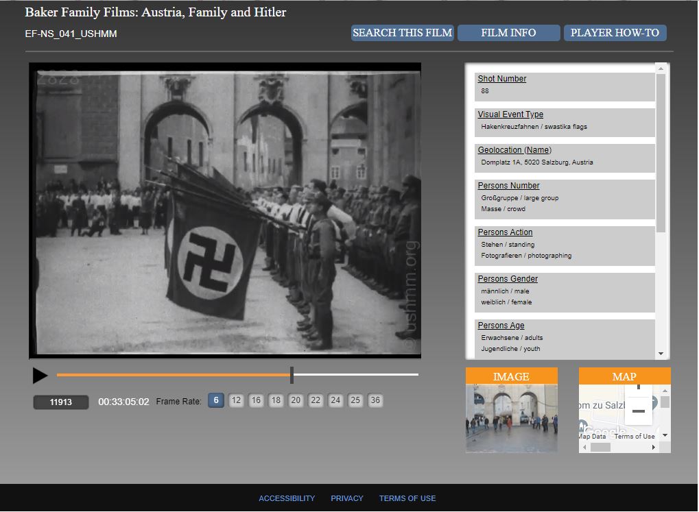
present-day location overlays the video, It’s pretty cool!
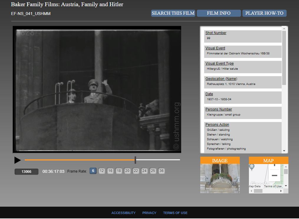
I thought I would share some of the images and then describe the steps I used. I went back to the USHMM website and retraced my steps from November 29, when I discovered this feature. I found the exact video. No overlay feature. No player like in the images above. I have no idea how I opened the videos!
If I hadn’t saved the images, I would have thought I made it up! I even went back to my search history and clicked on the link I originally used on Nov. 29. Nope – the videos just open like regular. No player. No overlay feature. No idea how to recreate it. Sorry. Maybe a reader here knows? Maybe I happened on the site on the day they were beta-testing a new feature? I think I’ll contact someone at the USHMM and ask them.
But, it’s not a total loss- seeing that overlay feature reminded me of a few other websites of interest.
What Was There ( http://www.whatwasthere.com/ ) is a fun website where you can browse for vintage shots of specific areas. Of course, there are more hits for larger, urban areas. You can add to the collection, too which is kind of cool.
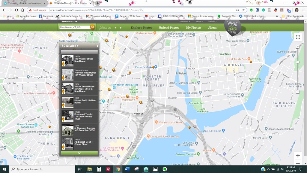
The images change as you move to different areas.
I really wish my hometown of Hamden, CT would adopt the mapping technology developed by Maureen Taylor (The Photo Detective.) Maureen loves her hometown of Providence, Rhode Island. She has created the website Old Providence (https://oldpvd.com.) As she explained on her podcast (Epsisode 29) the site runs on ChronoCharts, an interactive web platform developed by GeneaLabs. Images of buildings are pinned to a historical map based on their date of construction. You can add your own information as well.
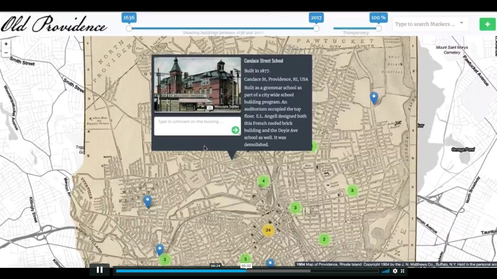
An image of a building is shown and described with its location pinpointed.
Sometime ago, I read that our Town Clerk, Vera Morrison had scanned all the historical maps for Hamden, CT. I thought, “What a great project for our Historical Society!” I sent a message to the town but – no response. Maybe I’ll volunteer my services when I finish the 6482 (more or less!) projects currently on my list.
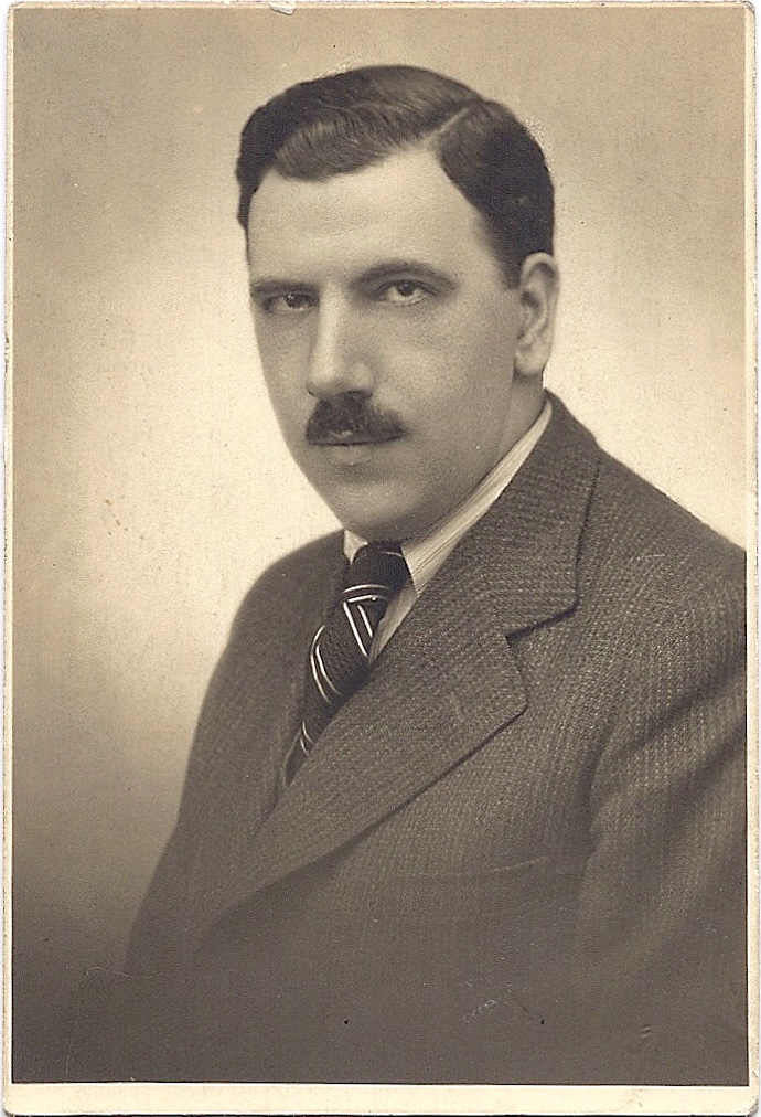
By the way, I’m dedicating this blog post to two special people: my high school and Maxwell’s Drug store buddy, Scott Robinson – the ONLY cartographer I know, and my grandfather, Paul Lichtenthal. Yesterday, Dec. 11 was my grandfather’s 119th birthday. It is in his memory that I am working on my current project – the story of his family’s business and how our lives were forever impacted when Hitler annexed Austria. (Click here to read a post I wrote some time ago about some of Paul’s experiences during the Holocaust.)